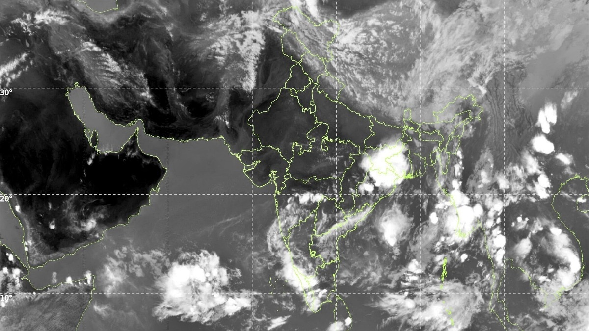
India’s weather pattern split sharply on Wednesday, with heavy rain and storms affecting the south while intense heat continued to grip large parts of the north and central regions. In the southern states, Andaman and Nicobar Islands received rainfall at most stations, while Telangana, Rayalaseema, coastal Andhra Pradesh, Karnataka and Lakshadweep also saw significant precipitation. Bhoothpur in Telangana’s Mahabubnagar district reported the day’s highest single-station rainfall at 11 cm. Heavy showers were also recorded in parts of Andhra Pradesh, Telangana, Rayalaseema, Tamil Nadu and Karnataka, and hailstorms were reported at isolated locations in Marathwada and Uttarakhand.
By contrast, heat wave to severe heat wave conditions persisted across East Uttar Pradesh, with heat wave conditions also affecting Haryana, West Uttar Pradesh, West and East Madhya Pradesh, Vidarbha and Chhattisgarh. As temperatures climbed, Prime Minister Narendra Modi urged people to stay safe and take precautions against extreme heat. In a public advisory, he asked citizens to drink enough water, carry water bottles while stepping out, watch for warning signs such as dizziness and fatigue, check on elderly family members regularly, and place water bowls for birds and animals in view of the heat stress on wildlife.


Weather conditions are expected to change on Thursday as a fresh western disturbance enters the region, bringing the potential for thunderstorms, strong winds, hail and dust storms across parts of north and central India. Punjab, Haryana, Chandigarh, Delhi and West Uttar Pradesh are likely to see thundersqualls with wind speeds of 60–70 kmph, gusting up to 80 kmph. East Uttar Pradesh may face similarly strong squalls. Isolated hailstorms are also forecast for Uttar Pradesh, Gangetic West Bengal, Haryana, Delhi, Himachal Pradesh, Punjab and Uttarakhand.
Strong thundersqualls of 50–60 kmph are expected in parts of Andhra Pradesh, East Uttar Pradesh, Jammu and Kashmir, Jharkhand, Odisha, Rajasthan and Uttarakhand, while dust storms are likely in Rajasthan and Uttar Pradesh. Heavy rainfall may occur at isolated places in Assam and Meghalaya, Bihar, Nagaland, Manipur, Mizoram, Tripura, Tamil Nadu and Puducherry. Even with the arrival of storm systems, heat wave conditions are still likely in several regions, including Chhattisgarh, East Rajasthan, Haryana, Delhi, Himachal Pradesh, Goa, Odisha, Punjab, Telangana, Uttar Pradesh and West Madhya Pradesh. Severe heat wave conditions may continue in East Madhya Pradesh, Vidarbha and West Rajasthan.
There is also some relief on the horizon as the southwest monsoon continues to make progress. On Wednesday, it advanced into parts of the southwest and southeast Arabian Sea, Lakshadweep, the Bay of Bengal and the remaining areas of the Andaman Sea. Meteorological conditions are expected to remain favourable for further northward movement over the next two to three days. In Northwest India, temperatures are forecast to fall by 6–8°C between May 28 and May 30, offering a much-needed break after prolonged heat.